Hiking
Eldfell
 |
 |
 |
|||
|---|---|---|---|---|---|
| 45 min. | 120 m | 1.7 km |  |
|
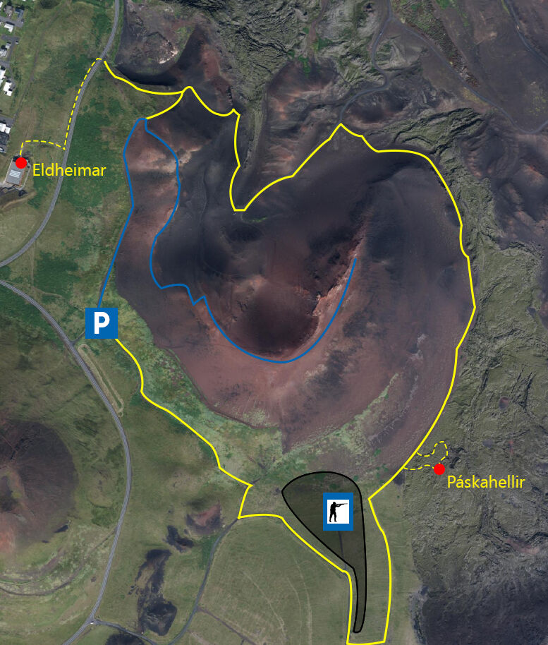
The walk has three starting points. The routes vary in length, time and distance above based on the route from the information sign in the car park.
- From the information board in the car park located by Fellavegur(Blue line)
- From the information sign to the northwest of Eldfell. ( Yellow line)
- From Eldheimar. Folllow a marked path towards Eldfell, continue along a road to the northwest where you will come to an information. (Yellow dotted line)
From all the starting points you can get both to the top of Eldfell and Páskahellir. This hike is ideal for families or those who do not have much experience of mountainhiking. However, it is important to be careful on moutain ridges and steep slopes.
Eldfell os a volcano that was formed in the Heimaey eruption in 1973. It is about 131 m high and stands east of Helgafell. A short distance from Eldfell is the Eldheimar museum, which tells the story of eruption.
You are at your own risk.